


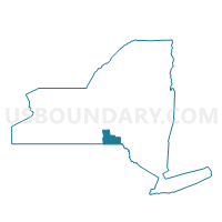
Voting District 15REST, Broome County, New York
About
Outline

Summary
| Unique Area Identifier | 625620 |
| Name | Voting District 15REST |
| County | Broome County |
| State | New York |
| Area (square miles) | 18.10 |
| Land Area (square miles) | 18.03 |
| Water Area (square miles) | 0.07 |
| % of Land Area | 99.60 |
| % of Water Area | 0.40 |
| Latitude of the Internal Point | 42.13797530 |
| Longtitude of the Internal Point | -76.07704200 |
Maps


Graphs
Select a template below for downloading or customizing gragh for Voting District 15REST, Broome County, New York


Neighbors
Neighoring Voting District (by Name) Neighboring Voting District on the Map
- Voting District 060001 060002 060018, Tioga County, NY
- Voting District 060003, Tioga County, NY
- Voting District 060004, Tioga County, NY
- Voting District 060013 060015 060017 060020 060021, Tioga County, NY
- Voting District 110001, Broome County, NY
- Voting District 110002-110004, Broome County, NY
- Voting District 150008 150056, Broome County, NY
- Voting District 150010, Broome County, NY
- Voting District 150015, Broome County, NY
- Voting District 150025, Broome County, NY
- Voting District 150029, Broome County, NY
- Voting District 150031 150041, Broome County, NY
- Voting District 150033 150034, Broome County, NY
- Voting District 150036, Broome County, NY
- Voting District 150037, Broome County, NY
- Voting District 150045, Broome County, NY
- Voting District 150046, Broome County, NY
- Voting District 150049, Broome County, NY
- Voting District 150057, Broome County, NY
Top 10 Neighboring County Subdivision (by Population) Neighboring County Subdivision on the Map
- Union town, Broome County, NY (56,346)
- Owego town, Tioga County, NY (19,883)
- Maine town, Broome County, NY (5,377)
Top 10 Neighboring Place (by Population) Neighboring Place on the Map
Top 10 Neighboring Unified School District (by Population) Neighboring Unified School District on the Map
- Union-Endicott Central School District, NY (31,710)
- Johnson City Central School District, NY (20,127)
- Maine-Endwell Central School District, NY (15,013)
Top 10 Neighboring State Legislative District Lower Chamber (by Population) Neighboring State Legislative District Lower Chamber on the Map
Top 10 Neighboring State Legislative District Upper Chamber (by Population) Neighboring State Legislative District Upper Chamber on the Map
Top 10 Neighboring 111th Congressional District (by Population) Neighboring 111th Congressional District on the Map
Top 10 Neighboring Census Tract (by Population) Neighboring Census Tract on the Map
- Census Tract 203, Tioga County, NY (7,063)
- Census Tract 133.04, Broome County, NY (6,039)
- Census Tract 102, Broome County, NY (5,377)
- Census Tract 133.01, Broome County, NY (4,979)
- Census Tract 130, Broome County, NY (4,391)
- Census Tract 134, Broome County, NY (4,337)
- Census Tract 136, Broome County, NY (3,738)
- Census Tract 137, Broome County, NY (3,299)
- Census Tract 132.02, Broome County, NY (3,189)
- Census Tract 133.03, Broome County, NY (2,768)